CURRENT AFFAIRS
Get the most updated and recent current affair content on Padhaikaro.com
India’s Geospatial Sector
- Vaid's ICS, Lucknow
- 17, Feb 2022
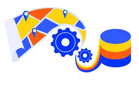
New guidelines have taken effect to completely de-regulate the geospatial sector in India.
About
- Geospatial data is data about objects, events, or phenomena that have a location on the surface of the earth.
- The location may be static in the short-term, like the location of a road, an earthquake event, malnutrition among children, or dynamic like a moving vehicle or pedestrian, the spread of an infectious disease.
- Geospatial Technology is an emerging field of study that includes Geographic Information System (GIS), Remote Sensing (RS) and Global Positioning System (GPS).
Applications
- There has been immense progress over the years in technology for capture of geospatial data through ground-based survey techniques, photogrammetry using manned/unmanned aerial vehicles, terrestrial vehicle-mounted Mobile Mapping System, LIDAR, RADAR Interferometry, satellite-based remote sensing, mobile phone sensors and other techniques.
New Guidelines
- Free access to geospatial data: The Geospatial data will be made available in the open public domain by the Department of Science and technology.
- Self Certification: Startups don’t need pre and post-approval certificates for adherence to guidelines. A self-declaration will work.
- Promotion of New Technologies: The government will promote the latest map-making technologies.
- Applicability: The Guidelines are applicable to geospatial data, maps, products, solutions and services offered by government agencies, autonomous bodies, academic and research institutions, private organizations, non – governmental organizations and individuals.
- Negative List of sensitive attributes: The Guidelines provide for a negative list of sensitive attributes to be notified by the DST to require regulation before anyone can acquire and/or use such sensitive data.
- The Negative List will include attributes that shall not be marked on any map implying that no person or legal entity shall identify or associate any location on a map with a prohibited attribute.
Significance of this sector
- India has a robust ecosystem in geospatial, with the Survey of India (SoI), the Indian Space Research Organization (ISRO), remote sensing application centres (RSAC)s, and the National Informatics Centre (NIC) in particular, and all ministries and departments, in general, using geospatial technology.
- Geospatial technology enables us to acquire data that is referenced to the earth and use it for analysis, modelling, simulations and visualization.
- Geospatial technology allows us to make informed decisions based on the importance and priority of resources most of which are limited in nature.
- Geospatial technology may be used to create intelligent maps and models that may be interactively queried to get the desired results in a STEM application or may be used to advocate social investigations and policy-based research.
- It may be used to reveal spatial patterns that are embedded in large volumes of data that may not be accessed collectively or mapped otherwise.
- Geospatial technology has become an essential part of everyday life.
- It’s used to track everything from personal fitness to transportation to changes on the surface of the earth.
Issues/ Challenges
- The full benefits have yet to percolate to the public and neither is there many contributions to the nation’s GDP.
- Absence of market: Among the most prominent hurdles is the absence of a sizable geospatial market in India.
- There is no demand for geospatial services and products on a scale linked to India’s potential and size.
- This is mainly due to the lack of awareness among potential users in the government and private sectors.
- Lack of skilled manpower across the entire pyramid is also a major issue.
- The unavailability of foundation data, especially at high-resolution, is also a constraint.
- The lack of clarity on data sharing and collaboration prevents co-creation and asset maximization.
- There are still no ready-to-use solutions especially built to solve the problems of India.
- Though India has many who are trained in geospatial this is mostly either through a master’s level programme or on-job training.
- Unlike the West, India lacks strata of core professionals who understand geospatial end-to-end.
Facts for Prelims :
Medaram Jathara Festival
- Medaram Jathara Festival is being celebrated from 16th-19th February 2022.
About Medaram Jatara:
- It is a tribal festival of honouring the goddesses Sammakka and Saralamma celebrated in the state of Telangana, India.
- The Jathara was designated as a State Festival in 1996, owing to the festival’s popularity and auspicious importance.
- It commemorates the fight of a mother and daughter, Sammakka and Saralamma, with the reigning rulers against an unjust law.
- It is celebrated once in two years in the month of “Magha” (February) on the full moon day.
- It is the second-largest fair of India, after the Kumbh Mela, celebrated by the second-largest Tribal Community of Telangana- the Koya tribe for four days.
- It is a festival with no vedic or Brahmanic influence.
- At present, the Jathara festival is biennially celebrated and organized by the Koyas in collaboration with the Tribal Welfare Department, Government of Telangana.